Rural Maps – making memories
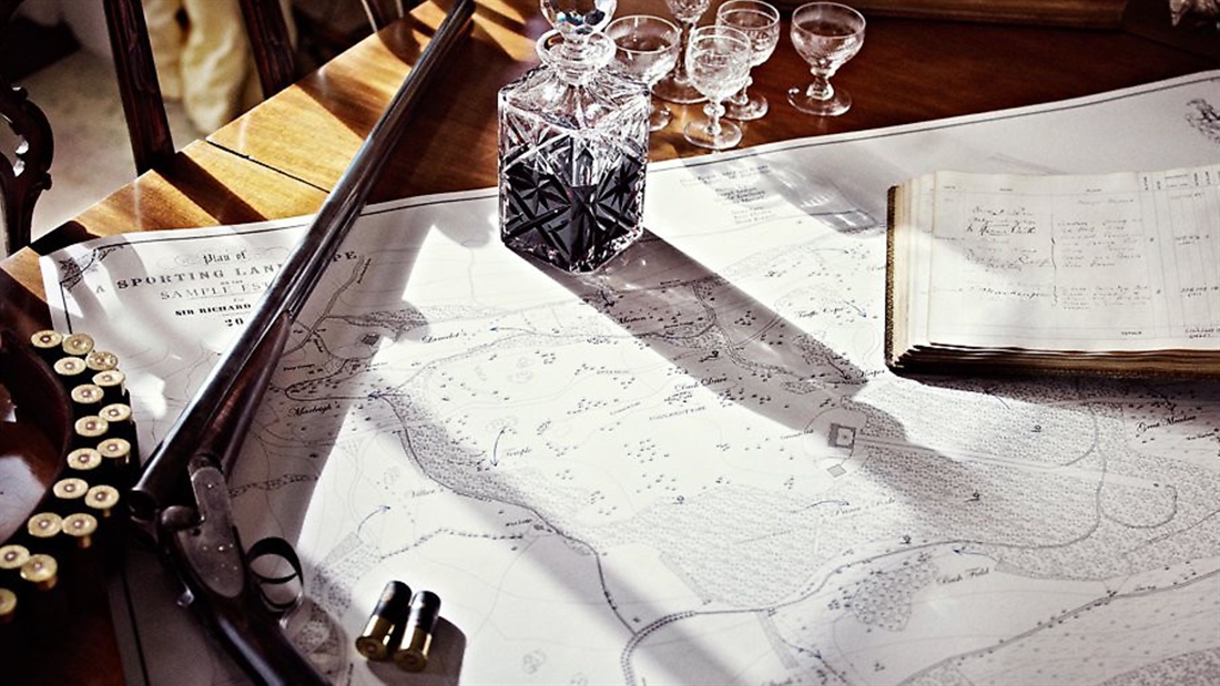
The Rural Maps team combine beauty and functionality in the most extraordinary way. We visited the cosy converted barn studio near Winchester to talk to the man behind the maps…
Rural Maps is one of those companies that truly epitomises all that Made in Britain has come to stand for. In our modern, mass-produced world, the combination of craftsmanship, personal service and passion for creating inimitable products with help from the UK’s top-end manufacturers has proven to be a winning combination for owner, Anthony Pelly.
In a nutshell, the company makes beautiful maps of rural land, both decorative and functional, operating on a worldwide scale with clients as far afield as Australia. I met the man in question one cold afternoon in late January, and was warmly welcomed into the cosy barn that is the Rural Maps studio, situated on the 1,300 acre Pelly family estate. At around half the age I expected him to be, the 34-year-old founder of this unique business clearly had an interesting story to tell.
HOW IT ALL BEGAN
After studying architecture at university, Anthony returned to the family farm he would one day inherit and began work there. Very quickly, maps became an essential part of that work. On the eastern side of the estate is about 300 acres of new parkland which Anthony created using money from a Higher Level Stewardship grant.
“We had a landscape architect, Kim Wilkie, design the scheme for us, but it involved a huge amount of rejigging and infrastructure change,” he explained. “Having an accurate map of what we had to begin with, what we were aiming for and where all the buried utilities like power lines and water pipes lay was crucial in carrying out this project efficiently, and not damaging the infrastructure. Those were the first maps I ever drew.”
Later, Anthony took this model and applied for a job at an estate in Suffolk where the owner was also doing large landscaping projects and found Anthony’s skills in this area extremely useful. “After I finished working there, I thought there might be a bit of a market for these maps, so I began selling them,” he said. “One of the first big breaks we had was a vineyard called Gusbourne Estate in Kent, now regarded as one of Britain’s finest wine producers. They commissioned this huge map of their vineyards, and row by row it was drawn with all the individual species and root stocks. That was the first large decorative map we did and it now hangs on their tasting room wall.”
After his parents’ retirement, Anthony took over the running of the family estate alongside his Rural Maps business. He told me: “I always knew that the farm was coming to me, but I wanted to have a second business which would be my own, one I could run until my parents retired and which would be complementary to running the estate.”
Just as he planned it, the combination works perfectly, with maps still being used heavily in the day-to-day running of the family estate. There are grazing maps showing fence lines, water pipes and troughs, as well as utility maps showing, for example, the exclusion zone surrounding a high-pressure fuel pipeline. Anthony also runs a shoot and manages deer on the estate, and being able to provide the deerstalker with a map showing unsafe shooting areas once again highlights how invaluable the maps are to estate management.
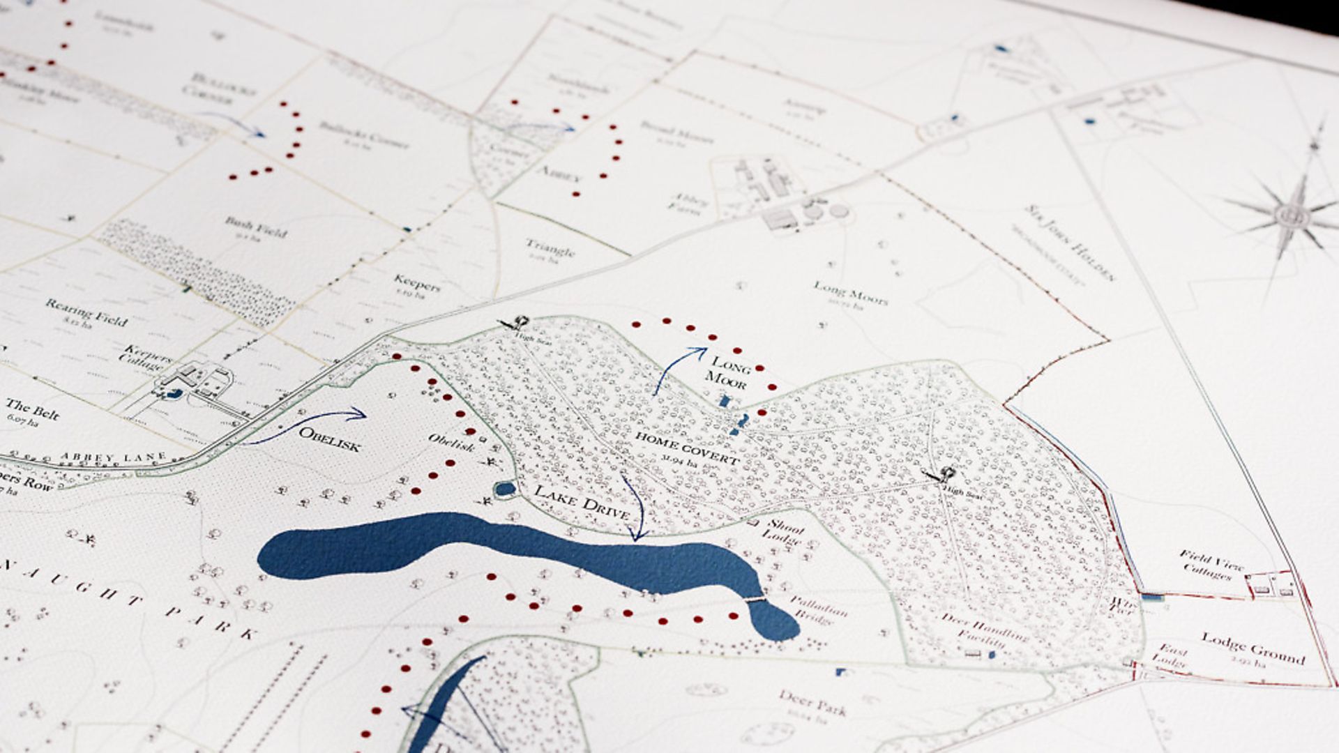
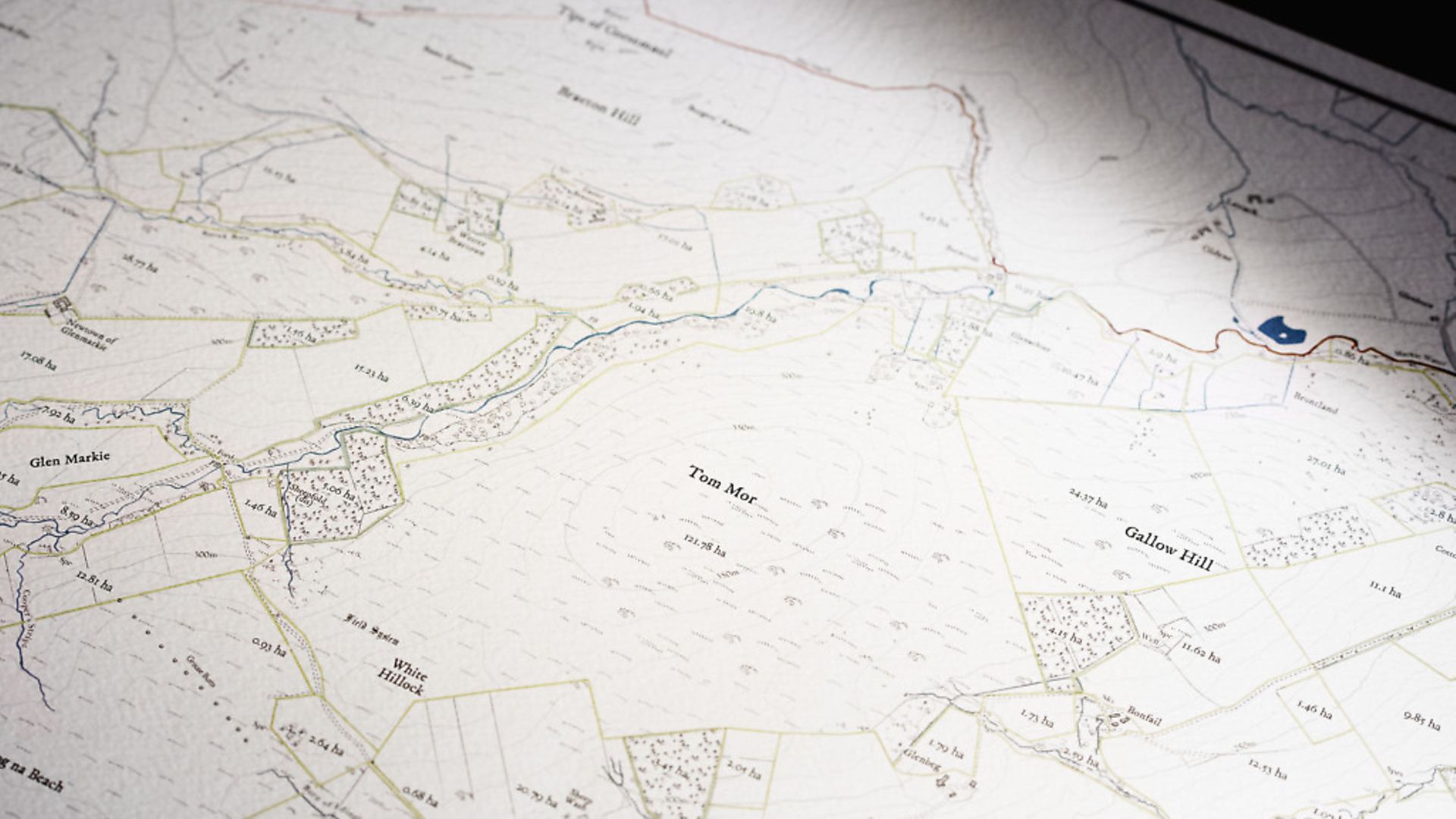
I was keen to examine some of Anthony’s more impressive commissions. These are maps unlike any I have seen before. The level of detail is breathtaking – from the inclusion of field names and shoot drives to the painstaking positioning of individual trees, they are not just geographically accurate but also serve as a personal memoir that the family can cherish for generations to come. Here are three examples that showcase the best of what this talented team can produce.
FLORIDA
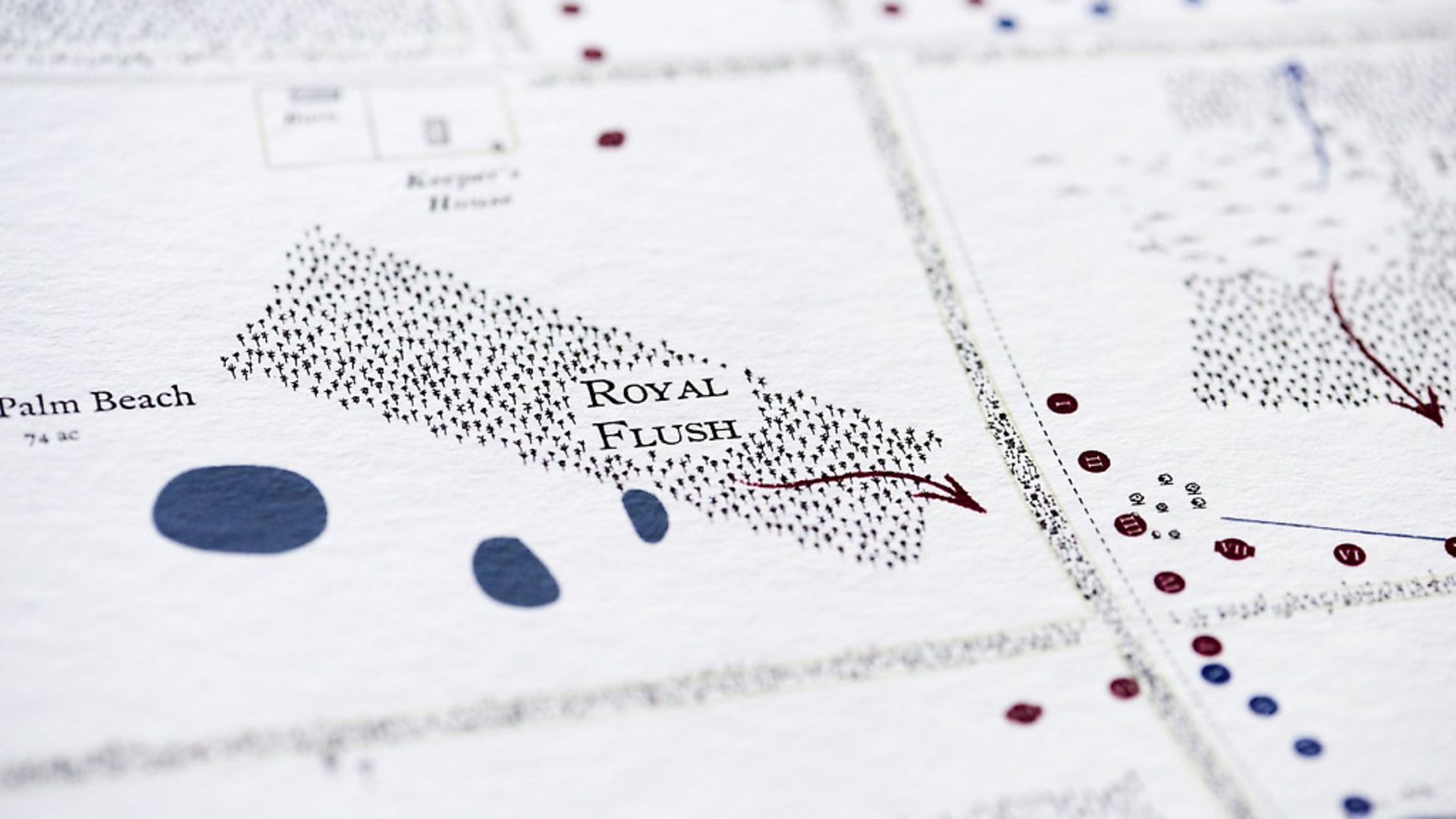
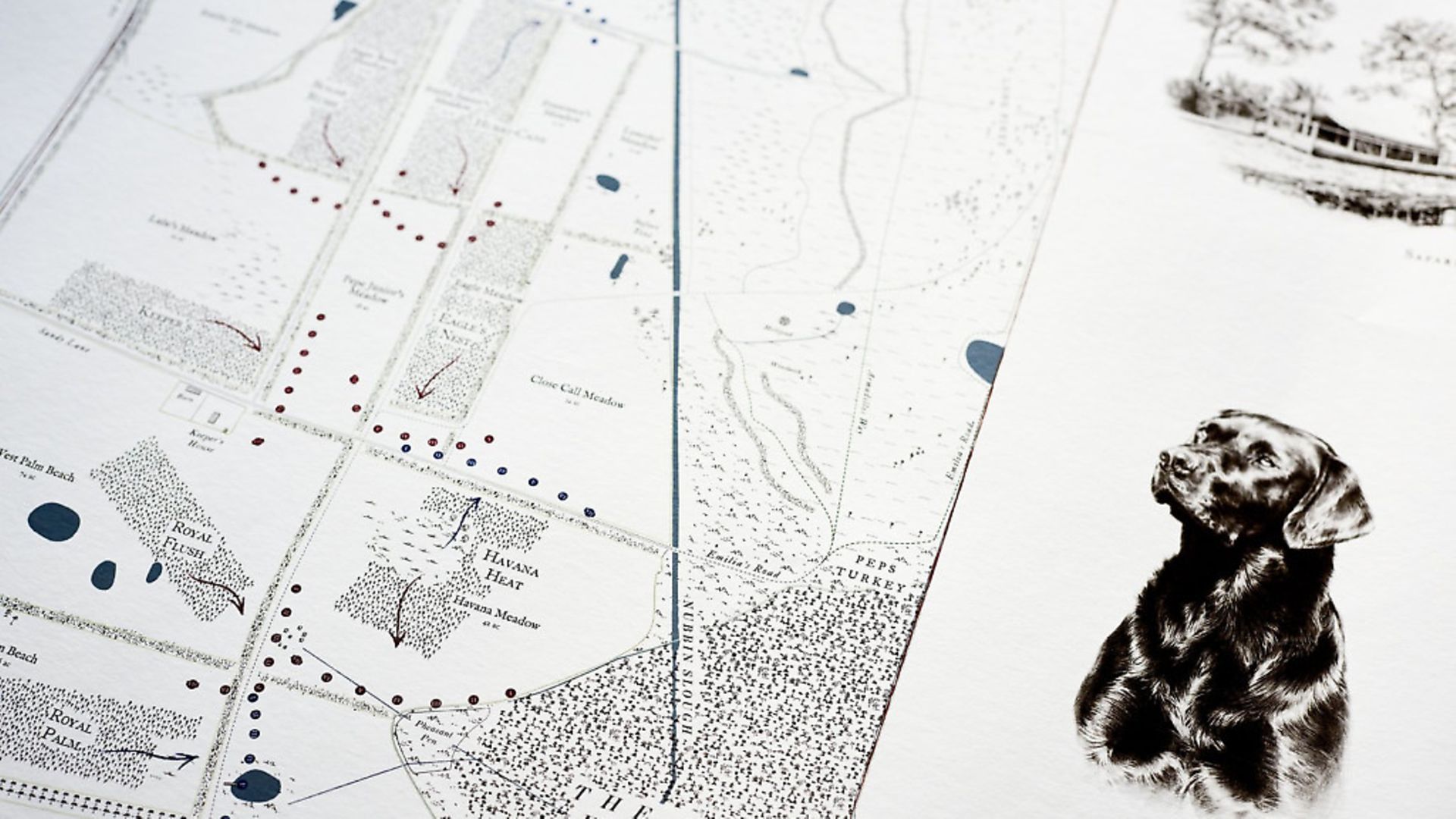
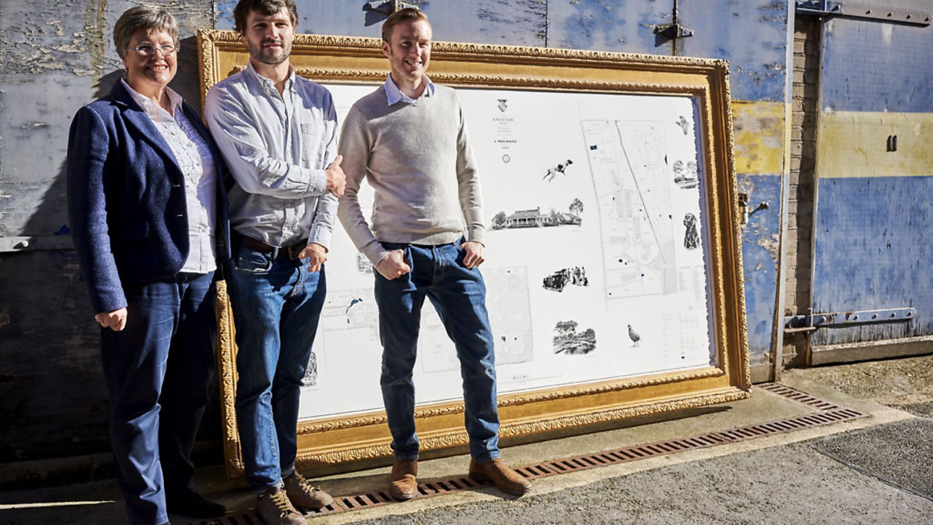
“This is the largest map we’ve ever done at 9ftx5ft,” Anthony said. “There are over 16,000 individual trees on the map, which Oliver [Anthony’s colleague] had to place. I spent a lot of time out there, mapping the estate, hunting with the owner and learning how the quail, partridge and pheasant shoots are run.
“Some clients have ideas about how they want something to look, but they just have to trust us! For example, they wanted watermarked backgrounds and photos on it, so I just had to say no and instead found the best illustrator, Jonathan Pointer, to draw the things that were special to the owner – the dogs, the house and the Rolls Royce which is actually their gun bus! Even the family’s coat of arms was redrawn from a faded photocopy instead of using logos. We used a British traditional frame maker to frame it – it is all hand-carved and gilded using 200-year-old moulds passed down through the generations.
“We also started hiding something specific to each client on their map; in this case, he loves his Labradors, so secretly hidden on this map at the height his grandchildren will be at is a tiny little Labrador. I can ask him in a year’s time if they have found the Labrador.
“The finished piece hangs out on his covered veranda, and he has now commissioned different versions of it for his family members and wants smaller versions made up to go in his other houses and yachts, so wherever he goes he has a bit of his ranch with him.”
PORTUGAL
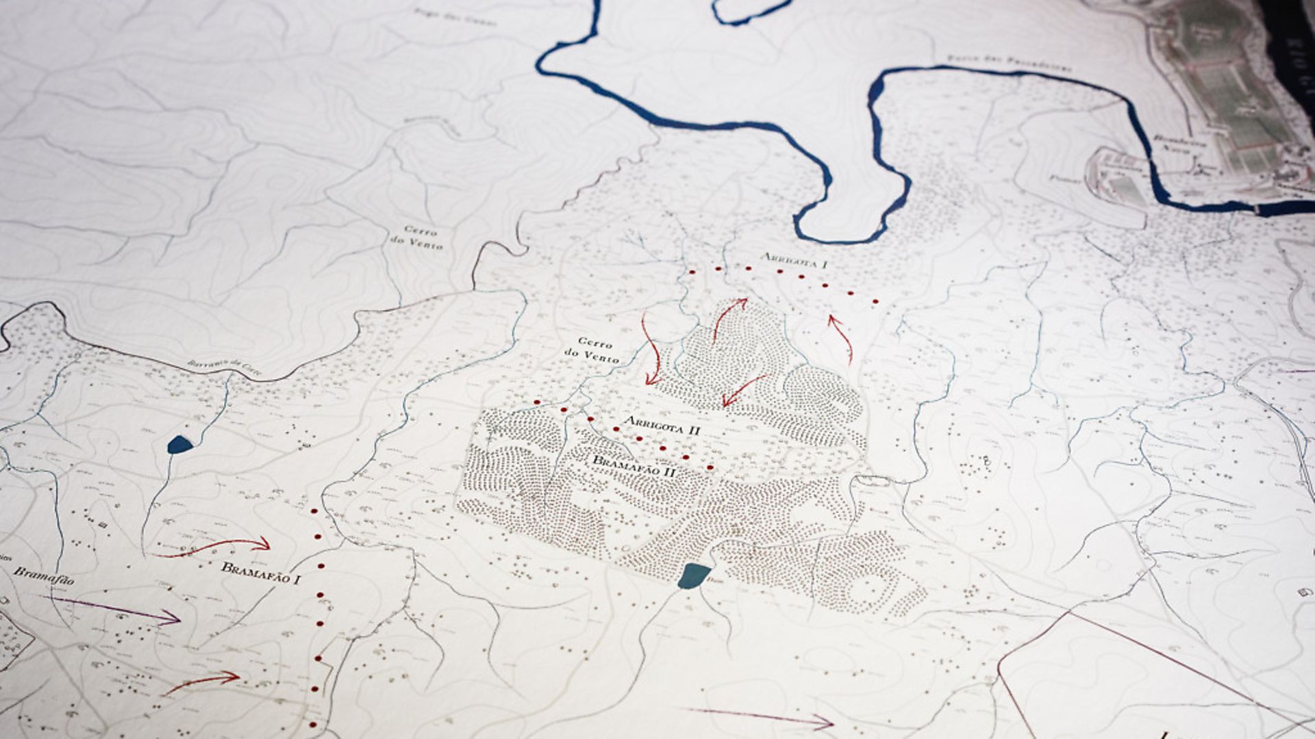
“This was for a wild partridge shoot on an estate,” Anthony told me. “It was commissioned by a group of mates who bought this place and they really love their wild partridge shooting. They also love their wine, so at the top they have their vineyards, and on the original is an illustration of the vineyards by the river.
“Their shoot is totally wild, and run very differently to an English shoot – the beaters get a lot closer to the Guns. The Guns themselves, about nine of them in a line, are all double gunning with a loader, a spotter, a recorder and normally their chauffeur as well all stood on the peg, so it’s a lot more crowded than an English shoot! They shoot quite a few hundred in a day, but they only do shoots about three or four times a year. “I went out there in 2017 and spent a week with them, went on a partridge shoot and drank their delicious wine – it was a lovely experience. It’s very important to spend time with the owner and find out what is special to them about these properties, as just by looking at it from our desks in England we don’t really know. When they stop and say: ‘Look at that view, you can see that steeple in the background’, I’ll put that on the map.
“There are beautiful old ruins and plenty of history to the place, there are vistas and view points, and they’ve planted lots of pine plantations along the lovely sweeping curves of these contours, which on a map I think look quite beautiful. The challenge here was the time it took to draw all of this, all of the individual trees placed along the contours.”
SCOTLAND
“This was a fairly early commission in 2015 of 5,000 acres up in the wilds of Scotland and, of course, they’re into their grouse shooting,” Anthony said. “We’ve got all their grouse butts laid out and all of the different names mapped out, for example the ‘crags’ and ‘bogs’, and there’s lots of ruins and an old castle here.
“We draw the woodland on different to the grassland and the moor, and where there are scrubby areas we mark those as scrub.
“What is crucial to all these maps is that Ordnance Survey is mapping for the masses, and it shows what everyone calls these places, but within these areas is a whole different layer of detail, and that’s how areas are run. What the owners and the people who work there call all these places is very personal. There will be special names for little knolls and hills and woodland, which Ordnance Survey have no idea about. Field names and shoot drives are another thing that we will add onto the maps.
“In the UK, we rarely go on site because it is a different price bracket and Ordnance Survey is very good, whereas with overseas clients it’s often the first thing they offer – to come and stay with them.”
THE PROCESS
UK MAPS: After making an enquiry either by phone or through the website, the client will be called up by Anthony’s colleague Catherine, who will ask them to send her any existing maps they might have, and gain access to the Rural Payments Agency – a government organisation that has the field boundaries for everyone in the country. From there, the team will draw up a quote and a mock-up of the map, with scale is indicated using the silhouette of a person in order to give an idea of how big it will be hung on their wall. Once the quote has been agreed, they will begin drawing the map and send the client a first draft for them to add to – this is when field names, shoot drives etc will be added. Once the client is happy, it is printed and sent. The whole process takes a couple of months, depending on how communicative the client is. British maps are mainly done using Ordnance Survey and planes taking aerial photos.
OVERSEAS MAPS: These typically involve the client calling up or making an enquiry online, followed quickly by an invitation for Anthony to visit the property in question. First, the team will work on a draft map showing the basics, and the draft will then be taken with Anthony when he does fly over to visit. He will usually spend a week or so on site, heading out each day with the client on quads or horses for a tour of the property, and will confirm from a long, pre-made list any suspected ponds, wells etc. while doing the rounds. This is also an important chance to spend time with the client and find out what is really important to them about the ground. For overseas maps in very remote locations where even planes rarely pass over, for example an Australian ranch on top of a mountain, Anthony commandeers a satellite to take the aerial photos needed! He explained this cool fact further: “Airbus Defence & Space, the world’s second largest space company, allow us to task their satellites. We can see on their website orbit paths and expected light levels etc, and can give them coordinates and an area of interest, and that will beam up to the satellite and tell it to turn its lens to this place and it will take a photo. Twelve hours later it comes back to us… it’s amazing! A fun thing we’ve done with some of our clients in the past is to tell them when the satellite will take the photo – it is a very specific time – and they’ll often write something on the ground to make the most of this photo opportunity. And when I say write, I mean in tyre tracks or they’ll burn an area or something, and then they can keep the photo!”
However the vital information is obtained, the map is then drawn and the finished piece sent to the client – when they finally unveil it, it will be the first time they see the completed product.
Visit www.ruralmaps.co.uk for more information or to get a quote

